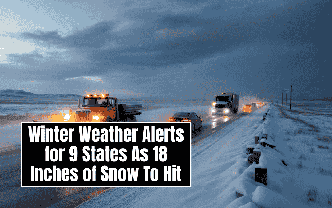
Nine states across the United States have been placed under winter weather warnings by the National Weather Service, with forecasts predicting up to 18 inches of snow in some regions from Sunday through Tuesday morning.
The affected states include Michigan, Wisconsin, North Carolina, Virginia, Tennessee, New York, Kentucky, Alaska, and Maine.
Why It Matters
Many regions are facing their first major snowfall of the season. The National Weather Service has cautioned residents that travel could become very difficult and urged drivers to take extra care during morning and evening commutes.
People are advised to prepare for slippery roads, especially over bridges and overpasses, and to allow additional travel time.
States Under Warning
Michigan
Several Michigan counties are expected to experience heavy lake effect snow. Mason and Oceana Counties could see up to 4 inches, while Alger and Marquette Counties may receive as much as 12 inches until Monday evening. Delta, Luce, and northern Schoolcraft Counties may get around 2 inches.
Keweenaw and northern Houghton Counties are likely to see up to 4 inches and wind gusts of 35 mph, creating blowing snow and poor visibility.
Additional snowfall of 5 to 8 inches could affect Gogebic, Ontonagon, Baraga, and southern Houghton Counties, as well as Alcona, Alpena, and Presque Isle Counties. Western coastal areas including Benzie, Grand Traverse, and Leelanau could see up to 6 inches by Sunday night.
Wisconsin
Ashland and Iron Counties, including the Bad River Reservation, may receive between 3 and 7 inches of lake effect snow until Monday morning. Vilas County could see up to 6 inches in higher elevations and 2 to 4 inches across the rest of the region. The heaviest snowfall is expected on Sunday.
North Carolina
Counties including Ashe, Watauga, and Avery are forecast to receive up to 3 inches of snow and wind gusts reaching 45 mph from Sunday night through Tuesday morning.
Higher elevations in Graham, Haywood, Madison, Mitchell, and Yancey Counties could see 4 inches of snow and strong winds, while Swain County may experience up to 8 inches, leading to possible power outages and reduced visibility.
Virginia
Grayson County may get up to 3 inches of snow and wind gusts near 45 mph. Smyth, Tazewell, Mercer, and Summers Counties could see between 1 and 3 inches of snow through Tuesday morning.
Western Greenbrier County could receive up to 6 inches, while parts of Pocahontas, Randolph, and Webster Counties may see up to 7 inches of snow and winds around 40 mph.
Tennessee
Eastern Tennessee could experience up to 5 inches of snow and winds reaching 40 mph, especially near Sam’s Gap along Interstate 26.
The Smoky Mountains, including Blount, Cocke, and Sevier Counties, could receive between 10 and 12 inches of snow near Mount LeConte and Newfound Gap, with lower elevations seeing around 8 inches through Tuesday evening.
Maine
The Central Highlands and northern regions of Maine could see icy conditions and up to 2 inches of snow through Tuesday morning. The heaviest accumulation is expected across the North Woods.
New York
Niagara and Orleans Counties could see rain changing to snow, with up to 5 inches expected by Monday. Jefferson and Lewis Counties might experience icy conditions and 4 inches of snow, impacting Monday commutes.
Chautauqua County may receive up to 6 inches, while the northern Adirondacks and St. Lawrence Valley could see up to 3 inches. Counties including Warren, Washington, Hamilton, and Herkimer may experience a mix of sleet, snow, and ice through Sunday afternoon.
Kentucky
Bell and Pike Counties are forecast to receive up to 2 inches of snow, with Harlan and Letcher Counties possibly seeing up to 4 inches by Tuesday morning. Higher elevations above 3,500 feet will see the heaviest snowfall. Drivers in mountain areas are urged to use caution during Monday’s commutes.
Alaska
The Kuskokwim Delta Coast, Nunivak Island, and western capes could experience 4 inches of snow, winds up to 50 mph, and visibility under half a mile.
Drivers on the Klondike Highway may encounter up to 18 inches of snow in high-elevation areas, while travelers on the Haines Highway could see 10 inches near the customs area and 3 to 7 inches near Haines through Sunday evening.
Statements from the National Weather Service
The National Weather Service emphasized that lake effect snow can create rapidly changing conditions, saying that weather can shift from heavy snow to dry skies within a few miles. Visibility may also vary greatly, and travelers should prepare for sudden changes in road conditions.
The New York NWS urged residents to report snow and ice conditions through their website or social media and reminded the public to slow down while driving and use caution on icy stairs, sidewalks, and driveways.
What Happens Next
Residents in the affected areas should remain cautious, check local forecasts frequently, and plan for hazardous travel. With varying conditions and strong winds expected across multiple regions, the National Weather Service continues to monitor developments closely as the winter storm progresses through Tuesday.
FAQs
Which states are under winter weather warnings?
According to the National Weather Service, nine U.S. states are under winter weather warnings: Michigan, Wisconsin, North Carolina, Virginia, Tennessee, New York, Kentucky, Alaska, and Maine.
How much snow is expected during the winter storm?
Snowfall totals vary by region, with some areas forecast to receive up to 18 inches of snow. In Tennessee’s Smoky Mountains and Alaska’s higher elevations, the heaviest snowfall is expected, while lower areas may see 2 to 6 inches.
When will the winter storm end?
The National Weather Service expects winter weather conditions to last from Sunday through Tuesday morning, with some regions seeing lingering snowfall and icy conditions into Tuesday evening.
What are the main hazards during this storm?
Residents should prepare for very difficult travel conditions, slippery roads, strong winds, poor visibility, and possible power outages. Ice accumulation in parts of New York and Maine may also create hazardous walking and driving conditions.
Which areas will see the heaviest snow?
The Smoky Mountains in Tennessee and the Klondike Highway in Alaska are expected to see the most snowfall, with totals reaching up to 18 inches. Northern Michigan, North Carolina’s high elevations, and parts of Virginia could see between 6 and 12 inches.
How can residents stay safe during the storm?
The National Weather Service recommends avoiding unnecessary travel, slowing down on snowy or icy roads, and allowing extra time for commutes. People should also dress warmly, stay updated through local forecasts, and prepare for possible power outages.
What is lake effect snow?
Lake effect snow occurs when cold air moves across warmer lake water, creating narrow bands of heavy snowfall. This type of snow can cause rapid changes in visibility and weather conditions within just a few miles.